Abingdon Flower Show: This year’s Abingdon Flower Show will be held in the Old Historical Abbey Grounds.
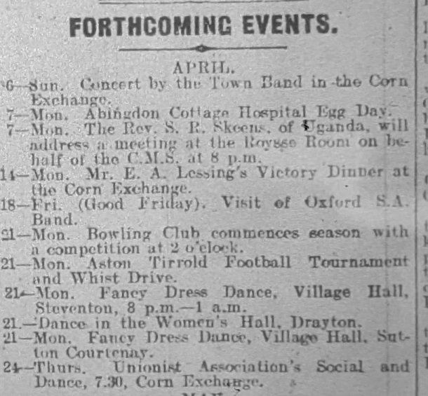
Town Band Concert: The Abingdon Town Band gave a successful concert in the Abingdon Corn Exchange.
Baptist Children Society Annual Egg Service: The Baptist CE Society held its annual egg services for juniors and seniors. The 240 collected eggs will be distributed among the sick and to the hospital.
Cottage Hospital: The matron thanks all those who donated eggs on Egg Day.
Birthday Gift for Rev. Morris: The Rev. J. P. Morris, pastor of the Baptist Church, Abingdon, was presented with a Christian Endeavor Hymnal by his congregation on the occasion of his birthday.
Good Friday Observance: Good Friday was observed quietly in Abingdon. The old custom of hot cross buns was still observed, but the cry of “One a Penny, Two a Penny” was conspicuous by its absence. Church services were held, and some people spent the day in the country or working on their allotments. The Salvation Army Band from Oxford also visited Abingdon and played at the Albert Park.
Easter Services: Easter services at St. Helen’s Church were well attended.
Abingdon Bowling Club: The Abingdon Bowling Club has issued its fixture card. The club has again entered for the Berks County Cup and the Preston Challenge Cup.
Police Court: William Fred Baylis of Oxford was fined for causing a nuisance in the Abingdon Market Place.
Football: Abingdon Town Club defeated Newbury in the Reading District League. Didcot lost to Childrey in the North Berks Cup Final. Both games were played at the Abingdon Town ground.
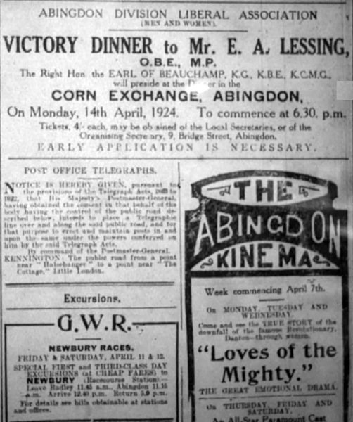
Liberal Victory Dinner: A celebratory dinner was held at the Abingdon Corn Exchange to mark the recent Liberal victory in the Abingdon Division. Earl Beauchamp, a former Liberal Cabinet minister, chaired the event. Mr. E. A. Leasing won back the seat for liberalism by a majority of 264. There were over 400 guests.
Excursions: The Great Western Railway Company announced special day excursions from Abingdon to Newbury Races. The Great Western Railway also offered cheap trips to the cup final between Aston Villa and Newcastle United.
Death of Reverend Herbert Thomas Maitland: The Reverend Herbert Thomas Maitland passed away at the age of 78 after a long illness.
Housing Scheme: At the town council meeting on Wednesday evening, the council agreed to make an application to the Ministry of Health for sanction to raise by loan £8,705 for the development of the Box Hill site near North Court, on the border of the town.
New Workhouse Master: The Board of Guardians has selected the new Master of the Abingdon Poor Law Institution from a list of candidates. They interviewed three, and the credentials of each were excellent. The choice fell on Mr. Richard D. Bushall from Kingston-on-Thames workhouse, where he had been assistant master for nearly three years. Mr. Bushall, who is 32 years of age, has gained a master’s certificate in the Poor Law Board’s examination.
Death of Mr. William Aldworth: The death of Mr. William Aldworth, Baker, and Confectioner, at 15 West St Helen Street, Abingdon, occurred at his residence on Easter Sunday, at the age of 69 years.
Boy Scouts Performance: The Boy Scouts of the North Berks Local Association will be presenting scenes from Abingdon’s history written by Miss Agnes Baker. An opening scene will sketch the beginnings of the town, followed by three episodes based around the second Saxon Church of Abingdon Abbey. The journey will then delve into the many merriments of a medieval fair. In the closing scene, there will be a picture of Henry VIII at Abingdon, some 20 years before his unscrupulous policy brought about the dissolution of our Abbey and many other ancient abbeys.
Unemployment Returns: The number of registered unemployed people in Abingdon is 109.
Joint Hospital Board Meeting: No business was transacted at the monthly meeting of the Joint Hospital Ward at the Isolation Hospital due to lack of quorum.
Dinner at Railway Inn: A dinner was held at the Railway Inn. Mr. S. Long occupying the chair and 62 guests sitting down to an excellent repast with entertainment provided by the ‘Oxford Knuts’.
Whist Drive at The Hut: A successful whist drive was held at The Hut, North Court. The highest score was 174, made by Mrs. A. Gerring.
Thank you for the news extracts and adverts from the Oxford Chronicle and Reading Gazette in the British Newspaper Archive. Also, thanks to the North Berks Herald microfilm in Abingdon Library for more adverts and news stories.