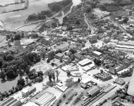
Thankyou to Malcolm for this aerial picture which expands the maps I showed a couple of days ago – on Abbey Close. The top wing of the de Havilland Dragon Rapide from which the picture was taken can just be seen in the right hand corner.
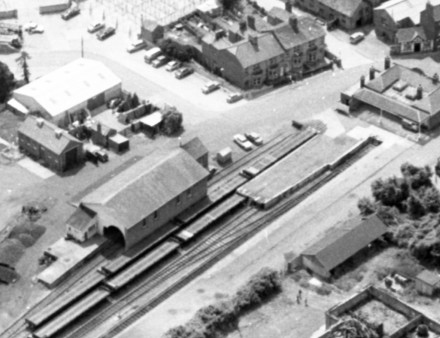
The railway station can be seen bottom right, the rolling stock are flat bed trucks which were used to transport MG cars.
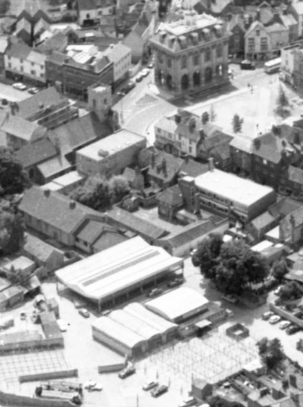
The pens of the cattle market can be seen in the area above that, together with St Nicolas Church hall.
i still remember visiting the cattle market in the 80s – for some reason my mum thought it was a good place to take kids in the school holidays.
Thanks for posting the above pics, superb.
Very interesting, Backstreeter.
thanks for that backstreeter (and malcolm). we moved to abingdon in 1978 and remember the cattle market and the mg deliveries to the station, and the archaeological digs where the vale offices and car park are now. it’s really interesting to see what went before.
Fab photos – many thanks for posting!
What a lovely town Abingdon was. A branch line, nice big goods yard that took cars made in the town to market, and the cattle market close by.
At least we’ve got nice council offices and a food shop to show for it all.
Nice pictures Malcolm.
I remember in the 1960s a rubbish dump in Abbey Meadow.
Fantastic aerials!
One note though, the middle photo of the rolling stock, are not flat bed trucks. There are 7* railway flatcars among the 2 tracks for shipping MG’s out.
*Could be the beginning of an 8th flatcar seen at the very bottom of the photo.