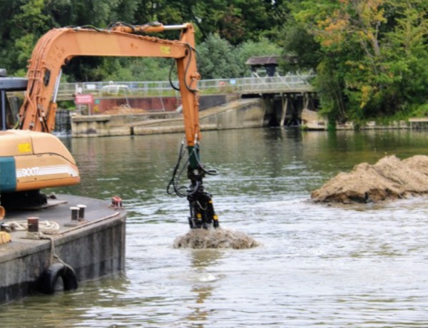
If you passed Abingdon Lock today, you may have seen an excavator on a floating barge, pulling mud from the river with its grab.
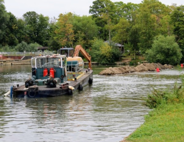
Silt collects below the weir and has to be cleared to keep the channel deep enough for boats. The spoil is swung either out of the navigation channel or onto the bank that has built up near the lock. That bank seems to grow larger each year and is now a favourite spot for geese. It may also help to keep the silt from drifting back into the channel.
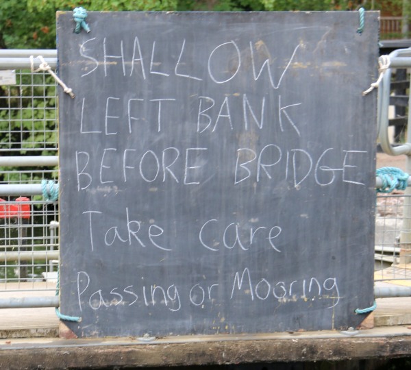
A local passer-by said they remembered the same work being done last summer. The Environment Agency has plenty to do, with flooding sometimes and silt at others. Although this summer has been dry, the river level does not look unusually low on the gauge downstream of Abingdon Lock. However, a notice at the lock warns boaters about shallows along the left bank before Abingdon Bridge.
As a new user of the river one gets embroiled in the eco system and the nuances of the whys and wherefores and governance of related infrastructure.
The EA is yet another failed quango(?) that not only sucks up money, mis-spends money, but also has had massive cuts to funding.
It is another barely fit for purpose entity that you wouldn’t really know about if you weren’t an active river user.
Welcome to the UK.
Where someone’s making lots of money, but none of us reap the benefits.
The gauge downstream of Abingdon lock is giving an incorrect reading – it has been reading about 40 cm too high for about the last two years. If you look at the physical measure on the side of the wall of the lock just below the down stream lock gate, it is indicating around 5ft , which is around 1.52 m, at the present time. The EA gauge is giving a reading of 1.95 m. Looking at the charts backstreeter provided links to, there is a clear jump in readings over the last two years.
The web page for the downstream readings records that ‘water reaches the highest level recorded at the measuring station (6 January 2024): 4.14 m. In reality, the level in January 2024 was around 3.75 m, around 0.1 m above the ‘property flooding possible level’. If the level had really reached 4.14 m, the consequences for Abingdon would have been more severe. The EA do not appear to check the data before publishing and hence flood warnings for the Thames at Abingdon are misleading – not a satisfactory situation?
I’ve pointed this out to the EA but no action has been taken – the lock keeper is also aware. I’m therefore of the same mind as Daniel that the EA is not doing the job it should.
Perhaps Layla can ask some questions when she returns to action?
When I first came to Abingdon some 40 years ago dredgers permanently went up and down the river at Abingdon dredging. It it thought that an EU directive stopped dredging. However, like everything else it might have been a cost factor.