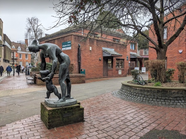
Built between 1973 and 1977, Abingdon library is part of The Charter, originally devised as the Broad Street North Redevelopment scheme, while Abingdon Borough was still in existence. (Abingdon’s local authorities all changed in 1974). The Charter, when finished, was run jointly by Oxfordshire County Council and the new Vale of White Horse District Council. It housed the library, medical centre, doctor’s surgery, social services, pensioners’ day centre, and a multi-storey car park.
The charter has dark red bricks, a variety of grey slate roofs , walkways on different levels, and plantings of trees and bushes.
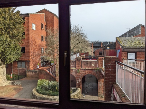
The library also a view towards Poundland and Broad Street.
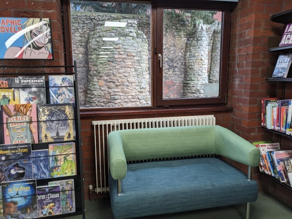
Another window has a view towards the decorative wall that holds The Charter foundation stone (1973) and the official opening stone (1977). The wall looks like part of an old castle, possibly a reminder of 1556 – the original Abingdon Borough Charter.
Thank you, ive always wondered what that strange wall was.
What has happened to the monk on the Tesco roundabout? It is splitting in two. A past town mayor said that a company dealing in wood in Abingdon offered to repair it, however, nothing has been done and the split is getting worse. It is a pity as the monk has become part of Abingdon’s scenary.
The Charter is a wonderful building and I am glad it’s being recognised at last. It has great potential with its walkways on different levels, unusual nooks and crannies and covered and open areas. We should make more use of it.
What is the old Charter/Alexanders nightclub being used for nowadays?
Thanks for the write up, I agree the Charter is a much overlooked asset to the town. Unfortunately it’s not the most appealing place to wander around in, especially at night. The design is symptomatic of the 1960’s/70’s obsession with elevated walkways and inward looking complexes (the Barbican estate in London being the poster child for this ideology) and suffers from its isolated position away from the Market Place, Square, and river. The Charter has no meaningful interaction with Stratton Way, Stert St, or Bath St, expecting its visitors to enter and exit through the end of Bury street alone, which nowadays is flanked by the empty husks of former anchor retailers. It has charm as an artefact of 1970’s design philosophy but is otherwise a design failure.
The old wall left standing at its heart is likely a garden folly built for the swimming bath that once lay before it. This bath may also be the origin of the name for Bath Street. A map showing the bath is viewable here: https://maps.nls.uk/view/228799817
I think that old wall was part of some “ruins” at the back of a Bath Street property. Back in the early 1950s, we used to cut through them from Firzharry’s. You could climb up one of the fake little towers if you squeezed through some carefully placed planks. Once I slipped & got caught by my nose between them. I didn’t dare tell my mother how I got a sore nose! I don’t think it’s been the same since!!!