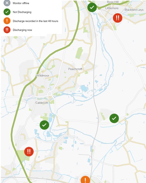
To stop streets and houses from flooding, storm overflows act as relief valves and allow extra wastewater from drains and sewers to flow untreated into rivers. A new storm overflow interactive map has been produced by Thames Water. The map can be viewed at https://www.thameswater.co.uk/edm-map, and this evening at 21:00, the map showed that storm overflow was happening upstream and downstream from Abingdon.
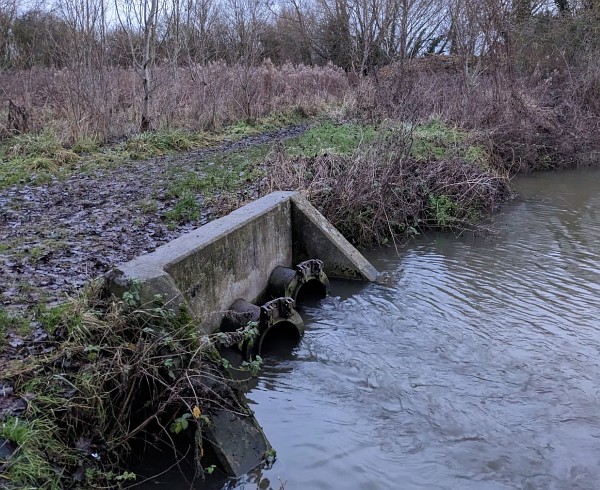
I think the site monitored nearest to Abingdon is the one pictured near the Abingdon treatment works and was not discharging.
Thanks to Newcomer for letting me know about this from an article he read in the Guardian at https://www.theguardian.com/environment/2023/jan/05/interactive-map-shows-thames-water-raw-sewage-discharges-in-england-rivers.
Hope no-one has a fit of the vapours over their mornng coffee, but this research is courtesy of the GMB:
https://www.gmb.org.uk/news/more-70-englands-water-industry-owned-foreign-companies
So, should we expect these major foreign shareholders to fix our sewage system? Well, your guess is as good as mine and we’d both be right. But wait … these shareholders are what our Hapless Govenment call ‘investor’s in the UK’! So, everything’s going to be okay …
China and the UAE are major investors in Thames Water … we’d better be careful about what we say, or we’ll end up to our necks in …. Oh dear, too late.
Abingdon is not discharging now but one wonders how it is going to cope with the thousands of new houses being built in Abingdon. A 3 million improvement to the works was done in 2012. I hope that this was enough to cope in the future.