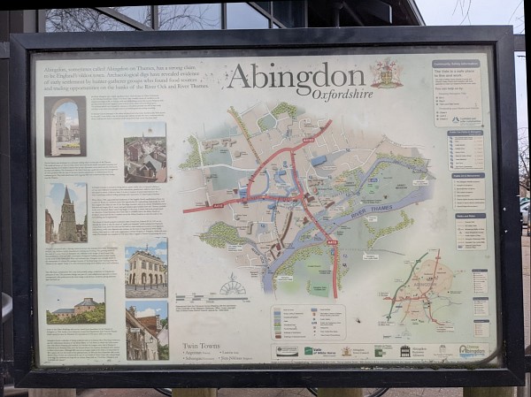
The town maps, produced as a Choose Abingdon project, look out of date. The original maps were designed digitally so they could be updated.
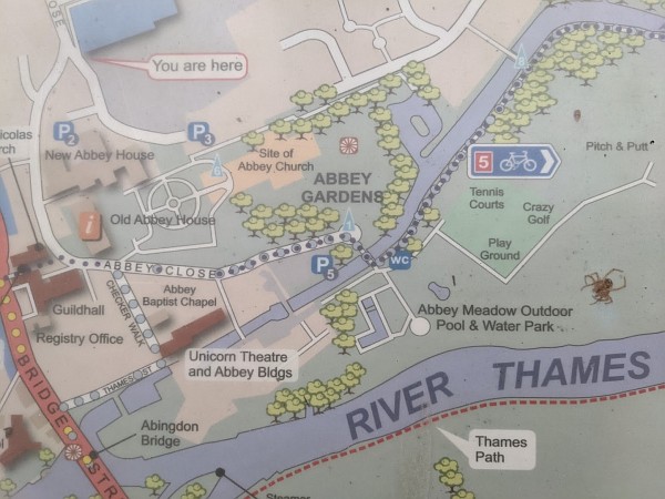
At least four things have changed in this section, and a spider has got stuck under the glass.
The information board outside the Abbey Gardens has come unstuck. It was probably created by VWHDC (Vale of White Horse District Council), being so close to their park. There is another information board nearby that is part of the Heart of Abingdon Heritage Trail.
This is part of a bigger problem about Visitor and Tourist Information, responsibility for which has fallen in to a vacuum between the Town and District Councils. Choose Abingdon (the name was chosen deliberately) helped to fill the gap, but since their demise little has been done. The Councils are strapped for cash, but it would be good to see a bit more priority being given to this.
Considering we are “the oldest continually inhabited town” in England, there is no brown tourism signage on the A34 to highlight this…
Fortunately there ARE signs for both Tesco and also Millets on the A34; so that’s nice.
You are of course right, Daniel. However last time I looked in to this, the cost was £18k for one sign – and that was a good few years ago. If the council wanted to spend that much money on promotion – and I wish they would – I wonder if that would be the best use of the money?
would love to see abreakdown of how a sign would cost £18k,when we had rows with the thankfully closed down abingdon BID, we were able to find signage that would be available in hundreds of pounds,whilst Abingdon BID quoted £40k which they refused to provide breakdown, mind you they refused to be transparent with anything, particularly to do with finances
Everyone wants their slice of the pie…
I cant remember where I found the £18k figure but if you have a few hours to kill, go on the Highways Agency and Oxfordshire County Council websites and you will see what hoops have to be gone through! The criteria are different for commercial outlets, tourist attractions and towns/villages.
The HA site says “As the applicant, you will need to cover the cost of any agreed tourist signs. A single sign may cost £8,000 to £20,000 to design and install if sited on a single or dual carriageway, depending on the size of the sign.”
Much as I would love to us to have some brown signs, I personally would rather see the Vale sort out the Upper Reaches site so we have an attractive gateway to our town. Then a decent tourist information website and marketing programme which would I suspect bring in more people than brown signs would.
I seem to recall brown tourist signs on the A34 was suggested a few years back and the (then) Highways Agency said no.
Amesbury is the oldest contually inhabited town in England, since 8820 BC.
Continually and continuously. I think Abingdon claims the latter (which means without a break). There are Neolithic traces here.
Amesbury claims the former (which includes breaks). Amesbury certainly has Bronze Age relics and has a wonderful stone circle; it is the start (or finish) of the old Ridgeway path.
I wonder what history we are making for future generations.
Amesbury Town Council actually claims ‘oldest continuos’: “Amesbury is recognised as the oldest continuous settlement in the United Kingdom.” A Daily Telegraph article from 2018 gives the title to Amesbury, saying it predates Stonehenge by 5000 years; Thatcham is given as 7700 BC; Abingdon 4000 BC. Proving ‘continuous’ is of course difficult!
http://www.telegraph.co.uk/travel/destinations/europe/uk/11596766/10-of-the-UKs-oldest-towns.html?
I think the pertinent issue here is whether or not Amesbury has a suitable sign off of THEIR passing A road directing all and others to THEIR local supermarket like what we does, or not?
£18k? 18K for 4 trees on the market place. 18k for a brown sign…
My confusion: Avebury and Amesbury (standing stones and Ridgeway). Sorry – hangs head in shame…..
im just glad that i can finally visit that part of abingdon, for years i’ve avoided it due to the giant spider i believed inhabited the area.
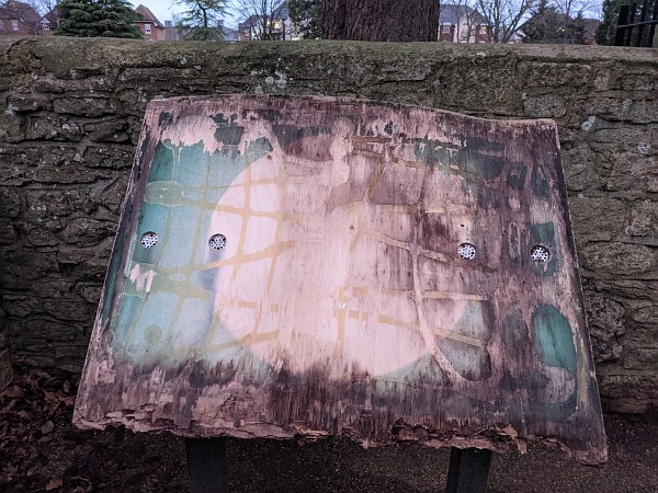
Going back to the information boards. I organised the replacement of two of them (Rye Farm and Hales Meadow) in memory of my husband Alan Bryden in 2019.
The maps were brought right up-to-date and the boards were re-positioned to make them more accessible. I expect the artwork is still available if anyone would like to use it. I was greatly helped in this project by many people who checked the maps and Richard Ballard from the Vale District Council who facilitated their installation.