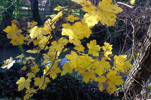
Anyone walking the Ock Valley Walk between Drayton Road and St Helen’s Close this December will be struck by the number of yellow leaves still on the trees.
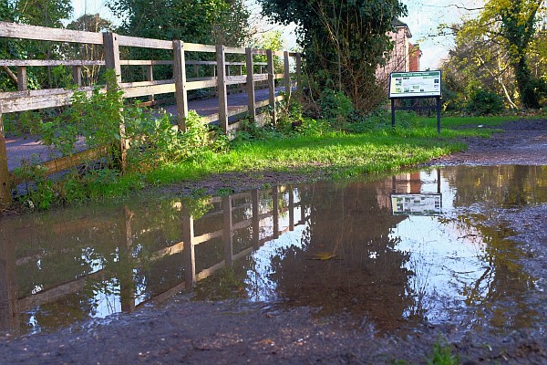
The path is muddy and despite wearing boots I got splattered.
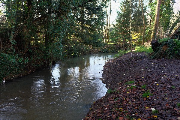
The Ock Valley walk is between two streams that carry rain water and some sediment down from the Vale of White Horse.
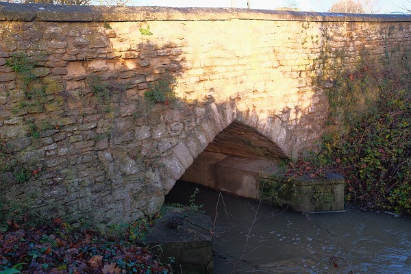
The River Ock flows under the busy Drayton road through two main arches.
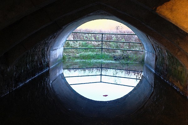
There are other arches which allow more water to flow during flooding. In 2007 even they were not enough. The water backed up and flooded the Drayton Road.
The rounded concrete on the far side is where the bridge was widened.
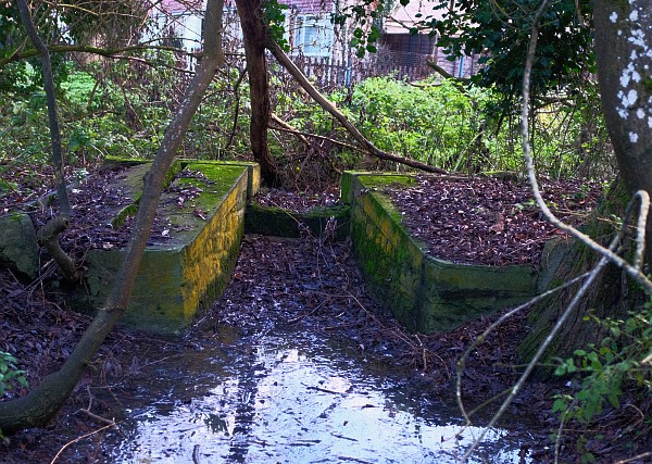
The water can flow from the upper to the lower stream at this mini weir – put in to protect Ock Street from floods.
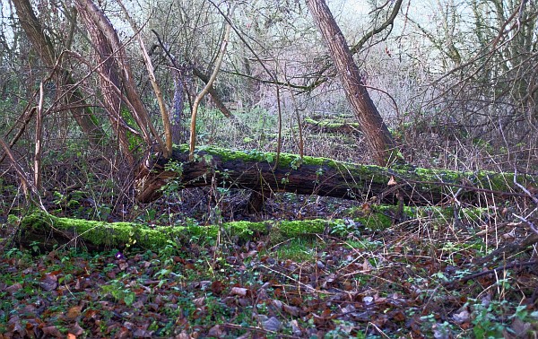
At the lower end of the walk there are a lot of old tree trunks, left where they fell, or piled in damp heaps and covered in moss – a home for creepy crawlies.
A friend of mine calls this walk between two streams is called Mesopotamia (between the rivers). It impresses me no end to walk to Mesopotamia – actually between the Tigris and the Euphrates.
As ever, Backstreeter, interesting information and splendid photos. Many thanks for another year so carefully catalogued.
I have lived in Abingdon over ten years but only discovered the Ock Valley walk this year. I have seen a couple of muntjac deer here, and more recently a young heron that was walking carefully in the shallows, apparently stalking fish.
Keep an eye out Jenny as there’s a kingfisher too!!
Yup, I saw it last month too which was lovely. Only problem was it flew off as soon as it saw my camera so my ‘expert’ photography only managed to capture a tiny blue blur 🙁
…yes, I believe you Iain 😉
We see the muntjacs quite regularly. Recently 2 parents and 2 youngsters. Didn’t see one this year, but there are Kingfishers to be spotted there. Unlike the bunnies, who used to thrive…until the 2007 floods.
I’ve walked along this path many times over the past 30 years and it always calms me, in any season. I too have seen muntjacs, kingfishers and a heron – we are so lucky to have this walk.
Thank you for the lovely walk.
Does anyone know the history or archaeology of it? Is it a man-made “island” the streams are at different levels, so I assume it is….but built when? By who? Why…?
According to the map, the Ock is the northern stream, on the town side of the island. It splits by Meadowside and flows down (seasonally) at the bridge on the Ock River walk down to the smaller stream. At this point the Ock has two flows…. both coming out at the little weir below the small wooden bridge at St Helens Court.
The smaller stream separates and starts off up by the tiny weir towards Tescos…then flows along the fields and the Chaunterell Way Play Area and fields…
Why is there this smaller “cut”?
Many streams and rivers in the U.K. are split, with the upper one being the leat stream feeding a mill further on. For the Ock, as it meets the Thames, Mill House is on the left – a bit of a give-away that – but quite how the streams ran at this point is not clear. I assume that the upper stream went into the Mill, coming out beyond the present final weir.
Perhaps in former centuries the Ock was navigable, at least by small craft, and presumably at some stage there was an actual water wheel at the Mill House. So perhaps the lower (southern) stream was made as a ‘cut’ to enable boats to by-pass the mill.
But is there a local historian who can shed light on this? It certainly seems unusual that there are two streams of a river so close to each other but at different levels.
In any river or stream which splits into a pair of channels, the lower one at the bottom of a valley floor always has to be the original river.
In that case it must be the upper channel that was cut, presumably to be a mill stream – like how the Abbey mill stream was cut. Perhaps the town wanted its own mill, to rival the Abbey’s, and used the Ock in this way to power it.
How much of our natural landscape is in fact man-made!
According to Google maps (which doesn’t mean you’re wrong) but it is the wider, northern flow that is “The Ock”. The slimmer flow splits off/starts at the shallow Weir by Tesco….and is indeed the ‘lower’ stream. But appears to have no name until it meets the seasonal Weir halfway along the Ock. Where both parts then become the Ock.
We have a dunnock in the garden and I was googling to find more about it. It seems that -ock is Middle English for “small “ and “dun” is brown. Even then they had LBJs in the bird world.
The Ock is therefore, presumably compared to the Thames, the small river.
Incidentally our dunnock had a set to with the resident robin this morning which was a really spirited affair.