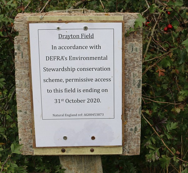
Daniel sent me a picture of a notice that has been put up at the permissive entrances to Drayton Field.
DEFRA’s Environmental Stewardship conservation scheme is run by Natural England, a government body. The scheme pays landowners for conserving the environment. In the case of this field it meant that the meadow grass and flowers were allowed to grow, and people were permitted to walk round the field.
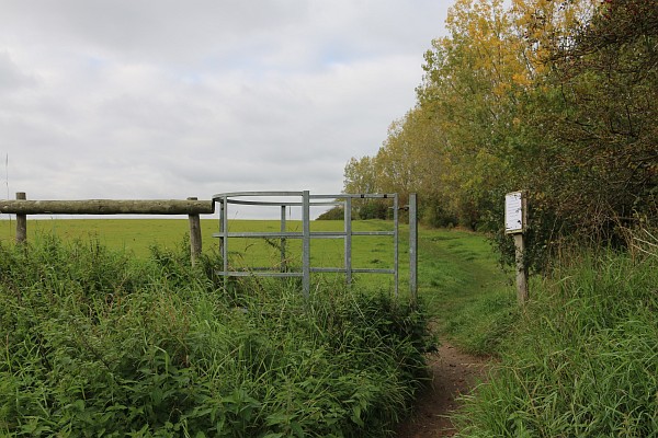
After it became permissive, gates were put in at the bottom end. There were also maps and information about the permissive access.
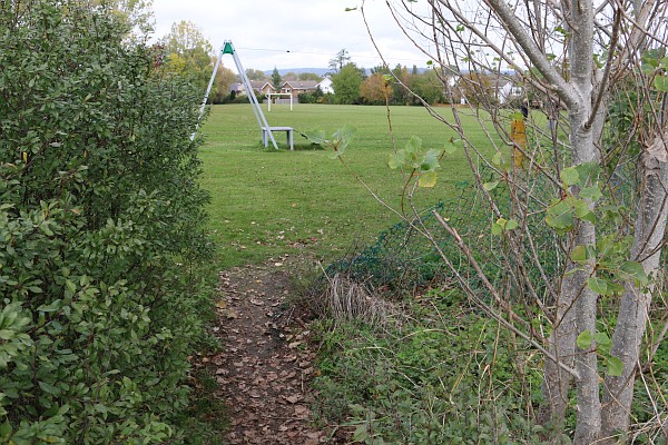
Most people access the field from a gap in the fence from Masefield Crescent Play Park.
Before access became permissive, the fence was continually being mended and broken down. It would probably take a developer building houses on this field to stop dog walkers. This field is not in the local plan so there is not immediate chance of this.
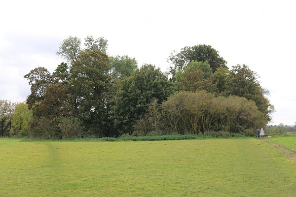
The most interesting feature of the field is the small wood at the south west corner.
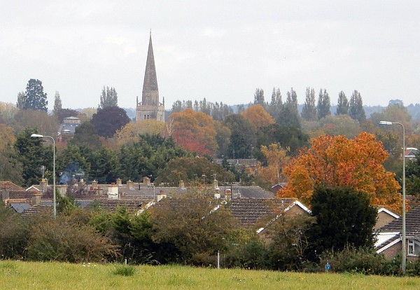
There are good views from that corner. You can see the Old Gaol and St Helen’s Church.
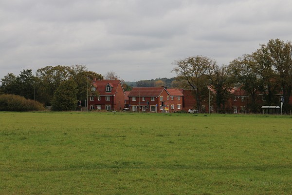
A recent change is that the Morland Gardens estate can be seen to the east.
Another recent change is that Drayton village is visible to the south.
Abingdon-on-Thames Town Council have identified this field as a possible site for a new cemetery.
Interesting photographic story. The photo I like the best is the last one which shows field in the foreground. Staying green is always a good thing .
Is this to do with the fact that it was European money which encouraged farmers to keep wide edges to their fields? That funding will now have to come from UK coffers; perhaps the money is drying up.
Nope
Drayton Field was sprayed with a herbicide a few weeks ago so the abundant wildflowers that were there are no-more
Not sure that the speculation about possible future use of this field as a cemetery is correct as it is understood that neither the Town or the Vale councils currently own the field.
I think it is reasonable to speculate that in the next year or so it’ll be having houses built on it. The privately owned land will be sold for the most money (and why wouldn’t it) and that’ll be to developers.
I have a very small hat, but if I’m wrong….I’ll eat it!
I can guarantee that I if it is not in the local plan then it will not be developed on whilst that plan is applicable. If you want to impact what may happen within in a new plan then contribute to the current governments proposals to change planning laws and get involved in the development of the next plan.
I understand that the land is owned by the Vale (I expect it’s leased to a tenant)
I think (if the location is where i think) it constituted a parcel of land that could have been used to complete an Abingdon ring-road however when approached The Veil said that they don’t know who the land belongs to so it wouldn’t likely get the permission.
I think you’re right, it likely does belong to them…they just didn’t realise.
Still…the very best town planners are on it, rest assured.
This is not the field earmarked for a cemetery – that location is situated behind the lowers numbers in Masefield (No’s 2 and upwards).
Moorland Gardens Phase II perhaps?
I lived on Masefield Crescent for 10 yrs and the top corner of Masefield playing field is a great vantage point for star gazing at night.
Does that mean the field will no longer be accessible? What about the footpaths leading to it? It is completely open to the west so will it be fenced off? There is a useful path leading to the New Cut Mill to Drayton path. Not a right of way but it would be a pity if that were no longer available.
The path from Mill Lane to Drayton than runs on the other side of the western hedge of the field is a byway open to all traffic and bridleway, apart from that there are no public rights of way.
The field is also home to an iron age / romano-british settlement
https://ancientmonuments.uk/101929-sutton-wick-settlement-site-abingdon-on-thames