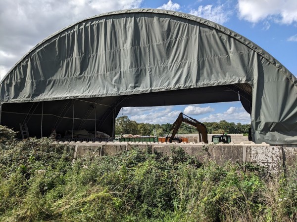
A waste transfer operation operates at the old coal yard off Thrupp Lane. The operation is the subject of a retrospective planning application open for comment until August 10th. The County Council has said that they believe the application is outside the development plan for the county.
The operation involves the sorting of waste by excavators under a large tarpaulin. The tarpaulin is intended to prevent dust from blowing, but dust and smell were still noticeable near the footpath (where I took this picture).
If you have any comments on the planning application, you can submit them to the County Council website: https://myeplanning.oxfordshire.gov.uk/Planning/Display/MW.0088/23.
The Abingdon Herald print edition (2nd Aug 2023) has a more detailed article on the same subject.