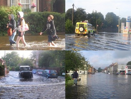
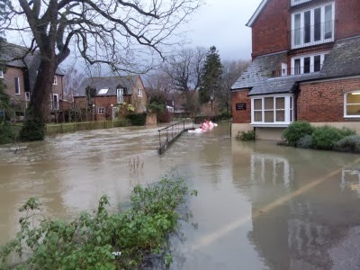
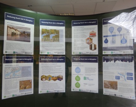
Category Archives: flood

Oxford and Abingdon Flood Schemes

Flood Defence
Over the last week there have been displays in the Community Free Space windows about flooding. On Saturday there was a chance to talk to people from the Environment Agency about the displays.

The Oxford scheme will work by diverting some flood water across the open flood plain and away from properties which flood at present. The Environment Agency have done their own modelling on the effects downstream to Abingdon, and unusually the VWHDC have commissioned their own independent study of the scheme.

There were also projects being looked at for Abingdon.

A 33.6 meter flood wall, to protect 5 properties at St Helen’s Mill from flooding, should be constructed between May and July 2017.

Options are being looked at for alleviating flooding from the River Ock including a flood storage scheme the other side of the A34.
Flood Defence
They have also been looking at deploying temporary defences. The more complex area to deploy such defences is around Tower Close and Meadowside, and they will trying to deploy a section of such defences in the next couple of weeks to get timings and note issues. Some ground work has already been done with residents.
Flood Defence
The defences are of the sort that has been already been used at Staines-on-Thames.
Flood Defence
Such defences would not deal with a flood of the scale seen in 2007 but could, with with the addition of pumps, protect from smaller floods.
Flood Defence
They will also be testing a deployment near the Ladygrove Estate. Then judge this along with other options such as flood storage.

You can find out more about the Oxford and Abingdon flood schemes at https://www.gov.uk/government/collections/reducing-flood-risk-in-oxford-and-abingdon.

Oxford Flood Alleviation Scheme Consultation at Abbey House

Oxford Flood Alleviation Scheme
In Abbey House, Abingdon, this afternoon and evening there was a consultation event about the Oxford Flood Alleviation Scheme. There was a good turn out. People were queuing outside when they opened, and about 200 people attended.
Oxford Flood Alleviation Scheme
Currently they are asking people what is the preferred route and type of channel from the Botley Road to Sandford Lock. The route is divided into sections. Section 1, near the Botley Road, has only one feasible option. Section 2 has four options etc. So we are being asked what is the preferred route in each of the places.

They are also consulting about how best to deal with the material dug out while creating the channel, and how to minimise disruption during construction. These seem to be questions more of interest for people near the route in Oxford.
Oxford Flood Alleviation Scheme
There was a board about flood alleviation options for Abingdon with smaller projects for the River Stert and the area near St Helen’Mill, and a possible larger project for holding back flood water from the Ock the other side of the A34. But that needs modelling, with the latest rainfall predictions which may need to be set 35% higher.
Oxford Flood Alleviation Scheme
The recommended route of the channel should be decided by summer 2016, and the detailed design completed in 2017. They will then hold a consultation before submitting a planning application. Everybody I asked from the EA (Environment Agency) said that the project should not make things worse for Abingdon. They need to demonstrate that before getting the go ahead.

The consultation is at https://consult.environment-agency.gov.uk/portal/area/se/flood/oxford/scheme?pointId=3765916.

Oxford Flood Alleviation Scheme – 2nd public event in Abingdon

Thanks to Hester and Pat for this …
Abingdon Brewery Tour
The Oxford Flood Alleviation Scheme is about reducing flood risk in Oxford and Abingdon.

The EA is holding public events to present options and provide an opportunity for the public to give their views.

The public meeting local to our area is on Wed. 20th January at Abbey House, Abingdon OX14 3JE. It will be open from 2.30pm to 7pm.
Abingdon Brewery Tour
Currently different options are being developed for the flood relief channel, including routes and flows. There was an exhibition last June where people were worried that if the flow of flood water round Oxford was increased it could impact Abingdon downstream. That could cause the Almshouses to suffer.

The option chosen will require planning permission and funding. The earliest start date is Spring 2018 with construction expected to take 2 to 3 years.

More information beforehand from the Environment Agency.

Oxford Flood Alleviation Scheme Consultation comes to Abingdon

Oxford Flood Alleviation Scheme Consultation
There has been a lot of flooding in Oxford recently. And so the Environment Agency, with funding from councils, are aiming to create a flood relief channel to the west of Oxford from the Botley Road to Sandford on Thames.

A few miles downstream from Oxford is Abingdon. So Abingdon has been included with Kennington, and a few venues in Oxford, to get this first consultation before design work starts. If you missed it there will be another consultation later in the year after design work is done.
Oxford Flood Alleviation Scheme Consultation
Consultants wanted to assure the Abingdon public, that although the relief channel would allow River Thames flooding to reach Abingdon sooner. the water levels would not go any higher (using their flood modelling techniques) or they would have to go back to the drawing board. They also wanted to pick up some local knowledge, and so were glad to meet with local flood groups.
Oxford Flood Alleviation Scheme Consultation
The only risk with their outline scheme, that I could see, is that Abingdon normally gets flood water from the River Ock and River Stert first, and then from the Thames a day or so later. What will happen if these different rivers are at their high point nearer the same time?