Category Archives: building work

A34 Lodgehill Diamond Interchange and 900 new houses in Abingdon got the go ahead today

A34 Slips
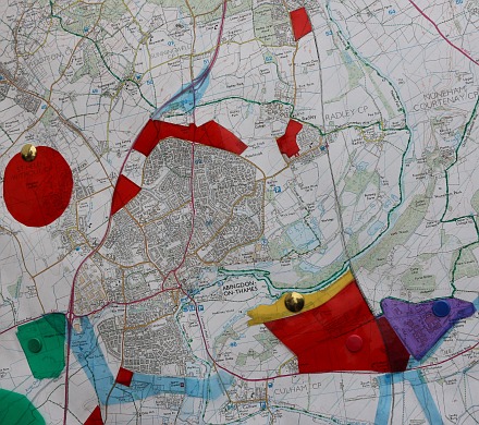
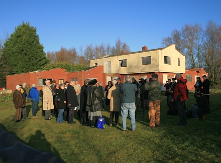
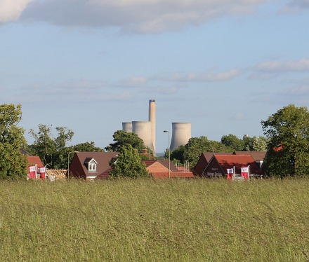
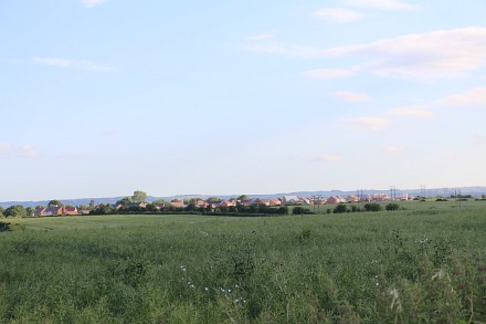
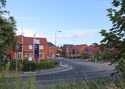
The postponed VWHDC (Vale of White Horse District Council) planning meeting to decide on outline planning permission for an estate of 800 houses north of Abingdon took place at the Amey Theatre in Abingdon School.

The meeting had been postponed because the Environment Agency had an objection, which has now been overcome with some modifications to the plan by CEG, the developer, who we learned had been working on this scheme for several years, and even worked closely with the VWHDC to get the VWHDC local plan adopted – which allows these 800 houses.
A34 Slips
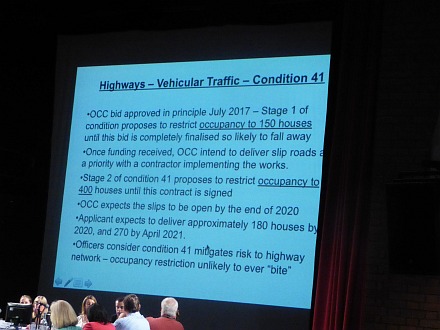
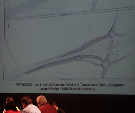
A government announcement earlier today removed the issue that could have held up the plan . It was dependent on the south facing slipways to the A34 at Lodge Hill being built to ease traffic in Abingdon. That slipway scheme will now receive about £9.45m over four years from central government. And central government has further funds to help open the way to new developments, allowing Oxfordshire County Council to feel confident they can ‘forward fund’ the rest – even before developer funding becomes available.

Oxfordshire County Council are now saying the slips could be open by the end of 2020.
A34 Slips
After the news of the A34 Lodgehill Diamond Interchange the rest of the detail was largely nodded through by the committee in a unanimous vote to allow the 900 houses.

People speaking against had asked that no houses be built until the new slipway to the A34 is built. 400 houses will be allowed. It was noted by objectors that the number of houses has now gone up from 800 to 900. Somehow that was explained by the council officer as being only ‘up to 900’. There will be less 2 bedroom houses, and more 3,4 and 5 houses. That was explained by the council officer as market forces.

On the positive side there was a commitment by CEG that 35% of the total will be affordable housing. There will also be a central area with primary school, community hub, and shop(s). CEG were praised even by some objectors for listening to the community, and said they would continue to listen.

Save Culham Green Belt

Culham Fete
At the Culham Fete last Saturday, the Save Culham Green Belt group had a stall.

South Oxfordshire District Council are looking where to put some more houses in their local plan, and are considering the new option of putting 3,500 on the Green Belt near Culham. It might even finance a bridge over the River Thames.
Culham Fete
The red areas on their map shows areas of new housing. If the scheme did make it into the local plan then the development would dwarf those in North Abingdon. They told me that 3500 houses would mean 8,000 to 10,000 people and 2000+ cars. The Culham population was 453 in the 2011 Census.

The green circle bottom left is a small part of the new reservoir being proposed again. Thames Water did a presentation on the reservoir proposal at Trinity Church two weeks ago. Not a lot of people knew that or they would have gone. I was told there were as many people doing the presentation as in the audience.

Sandles – occupied and unoccupied

Sandals
For many years Sandles was a private house, and Thrupp Lake formed part of the grounds – used for recreation and water sports.
Sandals
The lake and house were brought by nPower who applied for permission to fill Thrupp Lake with fly ash from Didcot Power Station. Locals then started up the Save Radley Lakes campaign.

In January 2007 Sandles was occupied by about 15 protesters, who stayed for about a month before being evicted, and then Sandles became a barracks for security men who patrolled the lake. A lot of trees were cut down at that time, preparing the lake for infilling.
Sandals
In December 2008, when this picture was taken, an agreement was reached between nPower and the Save Radley Lakes campaign that the Northmoor Trust would look after the lake as a nature reserve. Initial ideas were to improve access and viewing areas and possibly turn Sandles into an educational resource with outdoor learning space.
Sandals
9 years have passed during which better access has been provided, and viewing places. The Northmoor Trust has become the Earth Trust; Save Radley Lakes has become the Friends of Radley Lakes. Meanwhile Sandles has been been left bricked up, and visited by every graffiti artist in the area, until now…
Sandals
A week ago demolition began, and Sandles is now a pile of rubble.

New Estates seen from the Dog Walking field off the Drayton Road

New Estates
This evening, I walked round the dog walking field between Masefield Crescent and the Drayton Road. Looking down from the top of the field, the remaining cooling towers of Didcot ‘A’ Power Station are visible through a clearing in the trees – made for the entrance of the new Morland Gardens estate.
New Estates
On the west side, the wind blows across a field of barley – wave after wave.
New Estates
The south facing field has a crop of rape seed, and not far beyond, next to the village of Drayton, another new housing estate is being built.
New Estates
The new Morland Gardens estate is now the home for quite a few people, and houses are going up, out of sight, at the far end of this ex-horse-grazing field.
New Estates
The new estate is separated by a wall from Virginia Way and Lucca Drive so the older and new estates are kept separate. New residents cannot just cut through on foot.