In the library I got one of the new leaflets describing the Abingdon Abbey information trail. The leaflet has a map, and descriptions of the locations of the 9 information boards.
There is so much on each board that I find it better to visit one or two at a time to appreciate what they say. Part of the board near the bridge near the Abbey Gardens tells of the Abbey Fulling Mill – interesting to me at least as it makes a connection to a village I lived during my teenage years, where there was a fuller’s earth quarry. Beating cloth in a solution of fuller’s earth ( a kind of clay) and urine removed natural greases so that the cloth could absorb coloured dyes
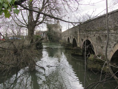
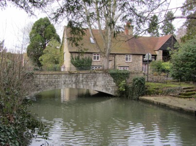
The information board by Abingdon bridge also says that the millstream was constructed by Abbot Ethelwold in the 10th Century, and it led to arguments with other mill owners as it affected their flow. (Information on the boards was researched and compiled by Abingdon Area Archaeological and Historical Society.)
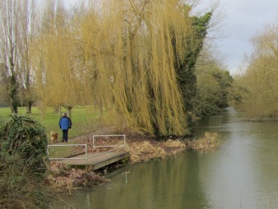
Nowadays the channel is quite overgrown near where it flows from the Thames.
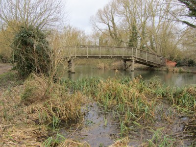
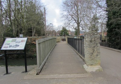
There are a number of bridges across the stream, some well know…
, and some off the main thoroughfare and less well known – like the one you cross to get to Cosener’s House..
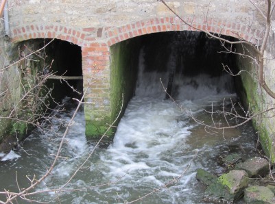
The mill stream emerges energetically from under the buildings near the Upper Reaches Hotel – who have restored a mill wheel to working order.
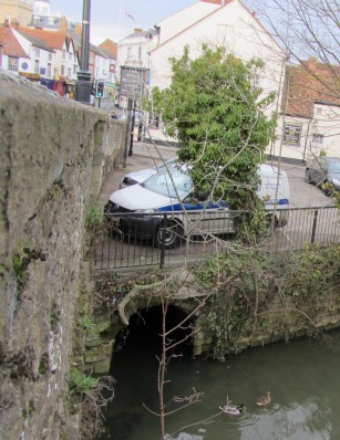
The stream is joined by the River Stert, as it emerges from its culvert, at Abingdon Bridge before rejoining the River Thames.
Absolutely fascinating! I live on Mill Road and had walked some of the route from the mill to the South. Your detailed information helps me to understand our town better.
Many thanks,
Paul
Paul, that mill on the Ock was Bugg’s Mill, presumably from the name of an owner. Mill Road used to be known as Bugg’s Mill lane, but that was before houses were built on Tithe Farm’s fields. No doubt the estate agents were grateful!
Oh, even better!
Paul – if you like this sort of thing, take a look at the “Abingdon Waterways Walk” booklet published recently by Choose Abingdon. It is a longish circular walk from Sutton Courtenay, along the Thames, through Abingdon then back via Mill Road and Drayton. It has masses of information about places you pass en route. It costs £2 and is available from the bookshops and Information centre.
You might also like to look at the Friends of Abingdonwebsite which has lots more of this sort of information.
I was confused by no 2 above as although I normally use my real name on this blog I post as Abingdonian on the Herald one. Not that it matters, as I am sure we will not disagree – but just for clarification, thought I would log that the person using that name here is not the same one as in the Herald!
I’m just wating for another Backstreeter to appear in the Herald so I can say it is not me.
I’m Backstreeter!
I’m Backstreeter!
I’m Backstreeter!
I’m Backstreeter!
I’m Spartacus!
If we are serious about ‘Green’ energy, shouldn’t all of these sluices be considered for micro-hydro-power generators ? Is the nonsense of a ‘water extraction’ permit still required ? (all the water is returned)
Spike – look up the Abingdon Hydro website for the latest on our local hydro electric scheme. http://www.abdingdonhydro.co.uk
Sorry. Typo! Make that http://www.abingdonhydro.co.uk