Category Archives: road works

St Helen’s Wharf closure and Lane Rental Charges

Work started this morning (9 June) beside St Helen’s Church. As a result, there was no through traffic along St Helen’s Wharf, and manned traffic lights were operating at the Iron Bridge to allow residents access in and out of the area.

The work was being carried out on behalf of Openreach and is likely to have been connected with improvements to the broadband network.

Residents living nearby, who experienced disruption from the gas mains works earlier this year, questioned why the two projects could not have been coordinated. However, the work was completed more quickly than expected. By this evening, the channel linking two BT access covers had been tarmacked over and the road had reopened. Road signs had warned of a 5 day closure and it appears to have been 1 day.
Oxfordshire County Council has introduced a Lane Rental Scheme to help reduce disruption from roadworks. More details can be found at: https://www.oxfordshire.gov.uk/business/licences-and-permits/lane-rental-scheme.

Under the scheme, charges of up to £2,500 per day can be applied for works on designated Lane Rental Streets during traffic-sensitive periods. From the published map, St Helen’s Wharf is covered by the scheme, giving contractors a financial incentive to complete the work as quickly as possible.

The scheme was not in operation during the much longer gas mains project. Had it been, Oxfordshire County Council might have collected a decent amount in lane rental charges.

Safer Crossing for Pupils and Residents on Faringdon Road


With the start of a new half-term, pupils returning to Larkmead School are using a new zebra crossing on Faringdon Road. The crossing, approved by Oxfordshire County Council in 2024 and funded through the Community Infrastructure Levy (CIL), was proposed by the local county councillor and introduced as a road-safety measure to serve pedestrians from Larkmead School, St Helen & St Katharine school opposite and local residents.

Faringdon Road is a busy road and can be difficult to cross, particularly at the start and end of the school day. The new crossing is close to both school entrances.

Abingdon East St Helen Street Active Travel Scheme: What the Consultation Revealed


Oxfordshire County Council has published the results of its informal consultation on plans to improve walking, wheeling and cycling through Abingdon town centre.

The overall picture is one of broad support. However, residents of East St Helen Street – who made up around 6% of respondents strongly opposed some measures.

The full results can be viewed at https://letstalk.oxfordshire.gov.uk/43234/widgets/147176/documents/103518

The consultation, held between 30 September and 28 October 2025, focused on a £1.47 million scheme funded through the Government’s Active Travel Fund. It would upgrade the National Cycle Network Route 5 (NCN5) as it passes through the town centre.

Proposals included:
* New pedestrian and cycle crossings at the Bridge Street / High Street junction
* A contraflow cycle lane on East St Helen Street
* Planting on East St Helen Street
* New informal crossings on both East and West St Helen Streets
* Early-stage ideas for a future contraflow on West St Helen Street (not yet funded)

Around 345 people completed the survey and more than 220 attending drop-in events at Abingdon Guildhall.

Support for individual elements varied.
Improved crossings at the Bridge Street / High Street junction were supported (strongly or partly) by 81% overall, and 50% of East St Helen Street residents.
The East St Helen Street contraflow was supported by 70% overall, but only 15% of East St Helen Street residents.
New planting in East St Helen Street was backed by 67% overall, but just 5% of residents on East St Helen Street residents.

Respondents with disabilities generally supported the proposals.

55% of respondents said the changes would make them more likely to walk, wheel or cycle in the area – an aim of the scheme.

Despite this overall support, several concerns were repeatedly raised.

Road width and safety
Many questioned whether East St Helen Street is too narrow to accommodate contraflow cycling alongside parked cars, pedestrians and delivery vehicles. Heavy goods vehicles serving local businesses were mentioned.

Parking pressure
Residents, particularly on East St Helen Street, were concerned about the loss of already limited parking spaces.

Heritage and character
There was worry about the visual impact of road markings, signage and materials on one of Abingdon’s most historic streets.

Crossing locations
Some respondents felt the proposed crossing points may not align with how people actually move through the area.

The consultation suggests that many people see benefits in safer crossings and a more connected cycling route through the town. At the same time, there are challenges in introducing these changes on a narrow, historic street.

Council officers are now reviewing the feedback to decide whether changes are needed before the scheme progresses.

As a reminder of current conditions, there was an incident on East St Helen Street today involving a car manoeuvring to park and another passing vehicle that hit the car and shunted it into other parked cars.

A34 Lodge Hill Junction Near Abingdon Taking Shape


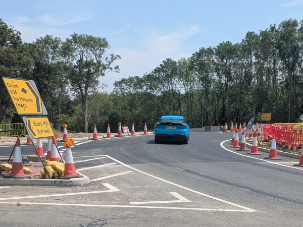
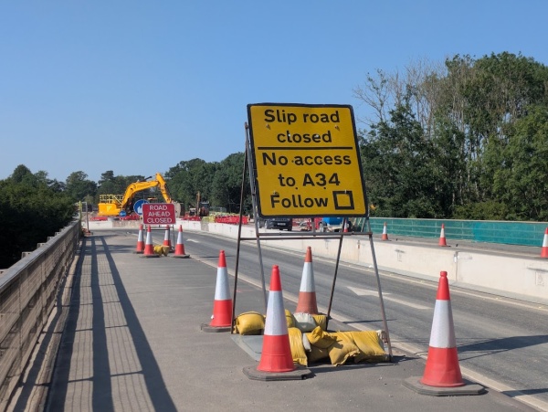
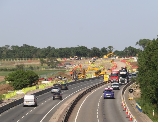
Work continues on the major redesign of the A34 junction at Abingdon, a project aimed at adding new roundabouts to support new south facing slip roads. Up to now there have only been north facing slip roads.

The temporary junction from Abingdon onto the A34 towards Oxford — which until recently gave priority to right-turning traffic over vehicles going straight ahead — is now starting to look more normal. With two thirds of one of the new roundabouts complete, traffic from Abingdon is now being guided around it before joining the A34 slip road.

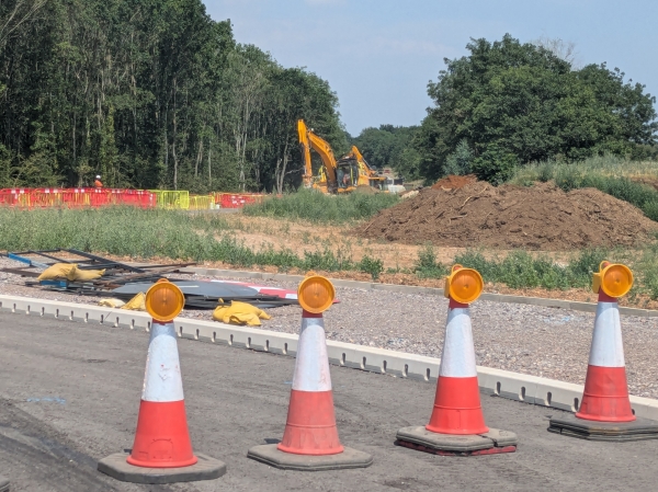
The second of the two new roundabouts is roughly halfway finished, although it is not yet in use.

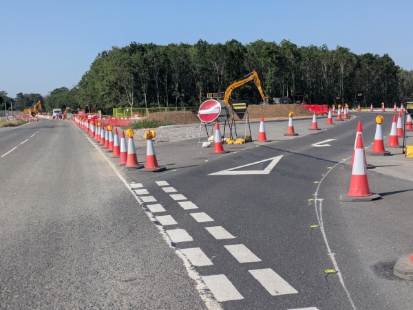
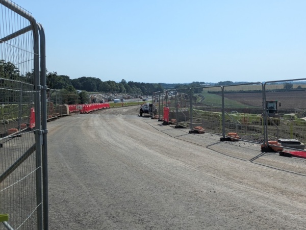
Looking towards where the new slip road from the south will run, warning signs are in place advising against trespass. One sign identifies the area as the ‘Moortown Working Area.’

At the site of the future southbound on-slip, the churned-up eath is beginning to take shape, with the base layer of a new roadway now visible.

Once complete, the scheme should improve traffic in Abingdon town centre and round the inner ring road by improving access onto the A34.