Category Archives: Uncategorized

Revised Walking and Cycling Plans for Abingdon Town Centre


Oxfordshire County Council has published revised proposals to improve walking and cycling through Abingdon town centre after taking account of feedback from last year’s public consultation.

The scheme, funded through the UK Government’s Active Travel Fund, originally had a budget of £1.47 million. It has since received a further £269,000, allowing the council to make several changes in response to concerns raised by residents and businesses.

The original plans included a contraflow cycle lane along East St Helen Street, new pedestrian and cycle crossings, and changes to the busy junction linking High Street, Bridge Street and Stert Street.

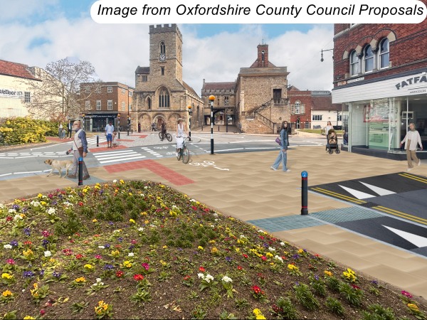
Following consultation, several aspects of the scheme have been revised. The illustrations below are my own mock-ups based on photographs taken today to help show the changes. They are not the council’s official drawings, so if you want to see the precise layout you should look at the plans on the council’s consultation webpage.

The main changes are:
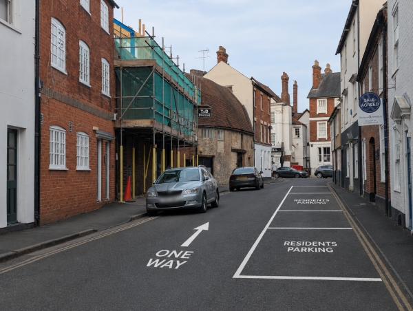
* No net loss of residents’ parking spaces. Parking spaces that need removing will instead be relocated. New residents’ parking will be created on Lombard Street and St Helen’s Court, while some shared visitor/residents’ spaces on East St Helen Street will become residents-only. To accommodate these changes, Lombard Street would become one-way eastbound for motor vehicles while remaining open to westbound cyclists.

* More loading space for businesses has been included.

* The proposed planting along East St Helen Street has been removed, allowing wider passing places along East St Helen Street.

* A new pedestrian crossing is proposed between Parasol Restaurant and The Punch Bowl.

* Another pedestrian crossing would be provided outside St Helen’s Church.
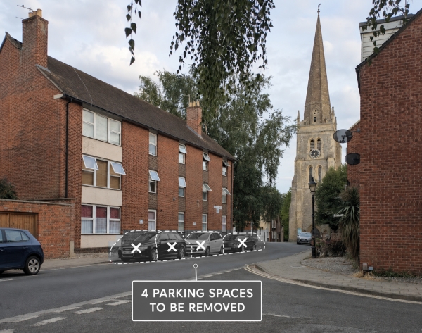

* A protected southbound cycle lane is added on West St Helen Street, linking St Helen’s Court with East St Helen Street. This would require the removal of four parking spaces.

How to comment:

The council is currently asking for feedback only on these revised changes, with comments open until 1 September 2026. See: : https://letstalk.oxfordshire.gov.uk/east-st-helen-street-active-travel-update

Later this autumn or winter, the council expects to hold a formal consultation on the complete revised scheme, giving everyone another opportunity to comment before any final decisions are made.

Flags Disappear from Saxton Road and Marcham Road


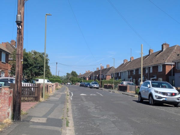
I cycled up Saxton Road today and noticed that all the flags had been removed from the lamp posts. Later, I saw that the flags had also gone from around the Marcham Road roundabouts.

The removals may be linked to reports that the group responsible for putting up the flags had agreed to stop displaying St George’s and Union Jack flags in Oxfordshire. The council has now arranged for the remaining flags to be taken down.

From Acacia to Topsport: World Cup Flags Around Abingdon


The 2026 World Cup, taking place across the USA, Mexico and Canada, got underway for England this evening with a Group L match against Croatia in Dallas. The tournament has already brought some colour to Abingdon, with a few local businesses displaying England flags in support of the Three Lions.

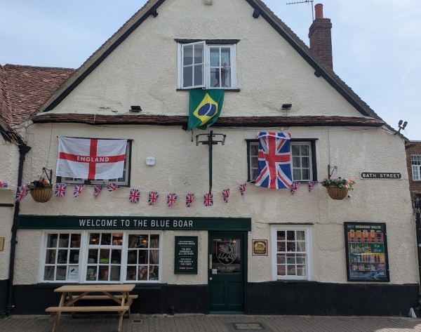
The Blue Boar has England flags, Union Jacks, and a Brazil Flag. Inside there are a lot more flags.

Sue Ryder has a large England flag inside the shop and World Cup signs in the window. These are mixed with their Fathers Day display. Fathers Day is on Sunday.

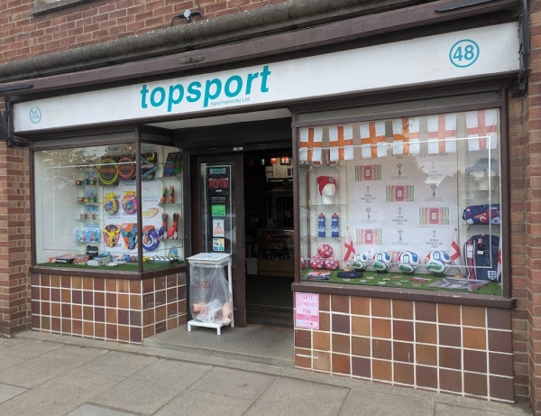
Topsport has one window dedicated to England / football and another featuring throwing rings. Inside, all 48 competing nations are represented by their flags.

With England’s World Cup campaign now underway with a convincing  4–2 win over Croatia,  more flags could begin to appear around Abingdon, in addition to those left by  ‘Operation Raise the Colours’.

Encouraging Nature Along the Paths at Radley Lakes


Martin pointed out that some recent work has been carried out along the edge of Thrupp Lake. It appears to be aimed at keeping people to the paths so that vegetation has a chance to recover and grow. At the south-west end, what looks like a hedge has been planted between the gravel path and the vehicle track to discourage people from straying off the route.

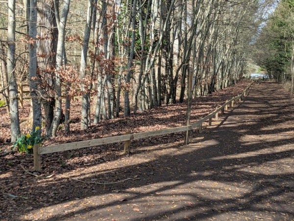
At the north-west end, a low fence now guides walkers onto a narrower route. Although there is a canopy of trees here and little currently growing beneath them, a notice explains the reason for the change:
‘Historic data shows that White Helleborine used to grow along this tree line. We’re hoping by fencing it off, this plant will start to reappear.’

The gravel path around the lakes is also more extensive than I remember and new fences have been added in places.

Meanwhile, old features from the lake’s previous life such as the old boathouse are becoming more dilapidated.

I filmed a full walk around Thrupp and Bullfield Lakes this morning using time-lapse to show just how much of the route has a gravel path. The result is like a roller-coaster ride. See
https://youtu.be/3aNWqWPfD7M